
By Paul Silverfarb
Sentinel Editor
It seems like it’s turning into a weekly tradition…people running in droves to the grocery stores, making sure they have the essentials for the upcoming winter Nor’easter.
For the past three weeks, there’s been winter weather that has greatly affected Greenwich and its surrounding areas. With turning the calendar from February to March and changing of the clocks, everyone seems to be dreaming that we are mere inches away from ditching the winter jackets and grabbing the short-sleeves.
Well, according to Jacob Meisel, Chief Weather Analyst at SWCTweather.com, residents of Greenwich might not want to throw away those sweaters just yet.
“What’s happening is that we are kind of locking into this pattern where there is a lot of upper-level blocking, where colder air over Canada gets displaced more easily across the United States,” Meisel said. “The pattern, which is kind of locked in, looks to be locked in for the next two weeks. We have cold being injected down in the Midwest and just spreading out into the Northeast. It looks like, at least until the end of March, like the bias is going to be towards the colder side.”
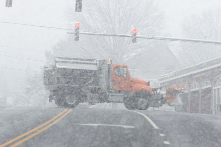
Greenwich and the surrounding areas started the month of March with a true Nor’easter, as winds were gusting over 60 miles per hour and snow was falling one to two inches per hour at times. A good chunk of the town was without power, as it was reported that over 150 trees and power lines came crashing down and were blocking roads, sidewalks and highways.
A week later, Greenwich saw its second storm fly into town. While the winds weren’t as strong, the town saw anywhere from six to 10 inches of heavy snow. A snow emergency was declared by First Selectman Peter Tesei. That snow event once again took down trees and power lines, just as some residents were getting power back from the first storm.
While walking up and down Greenwich Ave., it wouldn’t be difficult to find people talking about how this kind of weekly weather event feels like a rarity. After all, February was relatively dry and actually warmer than usual for that time of year. However, Meisel said to not let February fool you.
“Once you lock into a pattern, you’ll tend to see many of the same types of storms within a pattern,” Meisel said. “Through February we didn’t really have too many winter weather threats because we were in a warmer pattern and the jet stream was angled in a way where storms weren’t able to move up the coast and strengthen up the Northeast. Now we have that kind of orientation with the pattern makes it easier for any storm moving across the country to kind of get swept up and ride up the coast, really kind of sucking up this energy.
“Once you get into this pattern, it’s certainly not uncommon to get two, three, four Nor’easters, each one with different dynamics, strengthens a bit differently and has more or less cold air to work with,” Meisel added. “I can remember two or three times in the past decade where we got into a similar pattern.”
And we’re not done yet. Greenwich residents might want to resupply their Advil and gas up the snow plows once again, as Meisel said that he’s tracking another threat of winter weather heading our way.
“We have one more storm set that we are tracking late next Tuesday into Wednesday,” Meisel said. “Past that it gets more difficult to say. We do know that there’s at least one more storm threat that we are watching. If the features from the previous storms maintain, then we will watch any system that progresses across the country. We do think those will eventually degrade into April, so there’s really only one or two more storm threats that can remain based off the timeframe we are looking at here.”
With the winter months winding down, the question on basically everybody’s mind is “When it is going to feel like spring?” Meisel said that a few weeks ago, he would have said that we would have to wait until the beginning of April. But since then he’s adjusted his prediction a little bit.
“Some of the indications show that there could be a couple of cold shots, even in April, that necessitate, not necessarily winter storms or anything, but will keep it cold enough where people might want to keep the jacket around,” Meisel said. “As we progress through April, the pattern will eventually break down. It’s really only a matter of time, especially given the upstream across the Pacific Ocean. I would guess the second week of April, or if we are lucky maybe the first week of April, the pattern will break and we will revert back to seasonable warmth and eventually the expectation is that in late April we might see above average temperatures returning.”
While it’s quite difficult to predict spring weather in the first part of March across the Northeast, that doesn’t mean that Meisel has been keeping an eye on the upcoming season and whether it will be warmer or cooler than usual. He said that, as of press time, he hasn’t seen any signals pointing either way.
“Our expectations will be that as we move through the spring, May into June will be a slightly warmer bias, just because of the staying La Nina that is out across the Pacific Ocean. That will allow temperatures to be around average to slightly above average generally. However, the spring forecast still has a lot of noise and we are still trying to figure out exactly when this current cooler pattern will break.”