
By Paul Silverfarb
Sentinel Editor
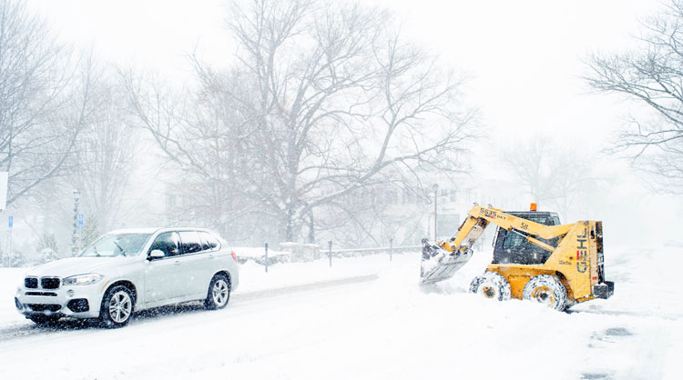
Well here is hoping the snow shovels aren’t packed away and the snow blower is gassed up, as once again Greenwich will be hit by a monstrous winter storm that will most likely dump more than a foot of snow up and down the state of Connecticut.

According to the National Weather Service, the winter storm that will start late this evening and last throughout the day Tuesday. In total, this storm is expected to bring to town the possibility of 11 to 23 inches of snow.
The snow should start after 1 a.m., with one to three inches possible before sunrise. Temperatures overnight will only reach the low 20’s, with wind chill values anywhere from 15 to 20. And the temperature shouldn’t get that much warmer Tuesday, as the high is expected to be around 27 degrees. The wind will also be a major factor Tuesday morning, as northeast winds will be from 25 to 32 miles per hour, and gusts as high as 45. That will cause blizzard conditions throughout the morning on Tuesday, with whiteout conditions likely.
During the heaviest part of the storm, snowfall has the possibility of falling two to four inches per hour. The National Weather Service states that there will be dangerous travel conditions for the morning commute and with whiteout conditions, several roads will likely be impassable.
If at all possible, stay off the streets and let the Department of Transportation easily access the sidewalks and roads for plowing and shoveling.
With the storm being so strong, the National Weather Service has issued a blizzard warning for Greenwich and the surrounding area that is in effect throughout Tuesday. In addition, a coastal flood advisory is in effect from midnight Tuesday until 4 p.m.
To read up on how to prepare for a winter storm, check out a recent story from the Greenwich Sentinel, which can be found here. Check back here throughout the day to see cancellations or any updates on the track of the storm.