
UPDATED: Wednesday, Feb. 8, 2017 at 7:50 p.m.: The Town of Greenwich is in for a massive weather change in the next several hours.
Hopefully with the warmer than usual weather that covered Greenwich earlier today people didn’t put the winter jackets away in storage just yet. Just as quickly as the near record-breaking warmth entered town, it will leave the area and bring with it some nasty winter weather.
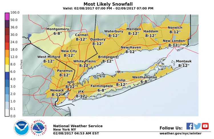
A winter storm warning is currently in effect for Greenwich and the surrounding areas, as much colder weather and heavy precipitation is moving in our direction and when it leaves the area, up to a foot of snow could be on the ground.
Already Greenwich Public Schools, as well as Sacred Heart Greenwich, Brunswick School and Greenwich Academy, have closed for tomorrow. That also means that all after school activities at the schools are also postponed or cancelled. In addition, several businesses around Greenwich will open much later in the day or not open at all.
Starting tonight, the temperature is going to nose dive. There is a slight chance for rain before 2 a.m., however the storm should change from rain to snow between 2 and 4 a.m. After that the precipitation will be all snow and start to drastically intensify throughout the morning. On Thursday the snow should last until the afternoon, with temperatures hovering around the freezing mark.
In addition to the snow, the winds are going to pick up during the weather event. On Thursday, winds will be out of the north 17 to 21 miles per hour, making the weather feel like only 15 to 20 degrees at times.
In total, anywhere from five to 11 inches are expected with this storm. The National Weather Service states that between early Thursday morning and into Thursday afternoon there will be very dangerous travel conditions. In addition, the snow could come down at rates between one-half an inch to two inches per hour, with visibility only one-half or one-quarter of a mile or less at times.
Also, the NWS states to watch out for blowing or drifting snow and the possibility or near blizzard conditions along the coast from Thursday morning to Thursday evening.