BLIZZARD CONDITIONS CONTINUING ALONG PARTS OF THE COAST
AT THIS TIME AS A MAJOR STORM CONTINUES IMPACTING THE
STATE…
At 5:45 PM radar and surface reports indicated that blizzard conditions are
still occurring along the southwest coast of Connecticut. Very heavy snow
is falling with NE winds gusting to 40 MPH at times. Heavy snow is also
falling across most of the rest of the state. As of 5:45 PM total snowfall
across the state has ranged from 4” – 8” in Eastern CT, 8” – 12” in Central
CT, and 12” – 16” in Western CT. Temperatures currently range from the
mid 20’s in northern CT to near freezing along the coast.
This Evening and Overnight: The heavy snow should begin to taper off to
light snow and mixed precipitation along the southwest coast between 7:00
– 8:00 PM, in Southern CT between 8:00 – 9:00 PM, in the Hartford Area
between 9:00 – 10:00 PM and up to the Mass border by 11:00 PM.
Northeast winds gusting up to 50 MPH at times may cause some additional
power outages. Moderate coastal flooding (tides 2 – 3 feet above normal)
is possible during high tide around 1:30 AM in western Long Island Sound.
Temps holding in the low to mid 30’s.
Tuesday: A light mix of precipitation in the morning should change back to
light to occasionally moderate snow Tuesday afternoon before ending
Tuesday night. Just a few more inches of accumulation is expected. A
minor to moderate impact is expected for the morning rush hour and a
minor impact is expected for the afternoon rush hour.
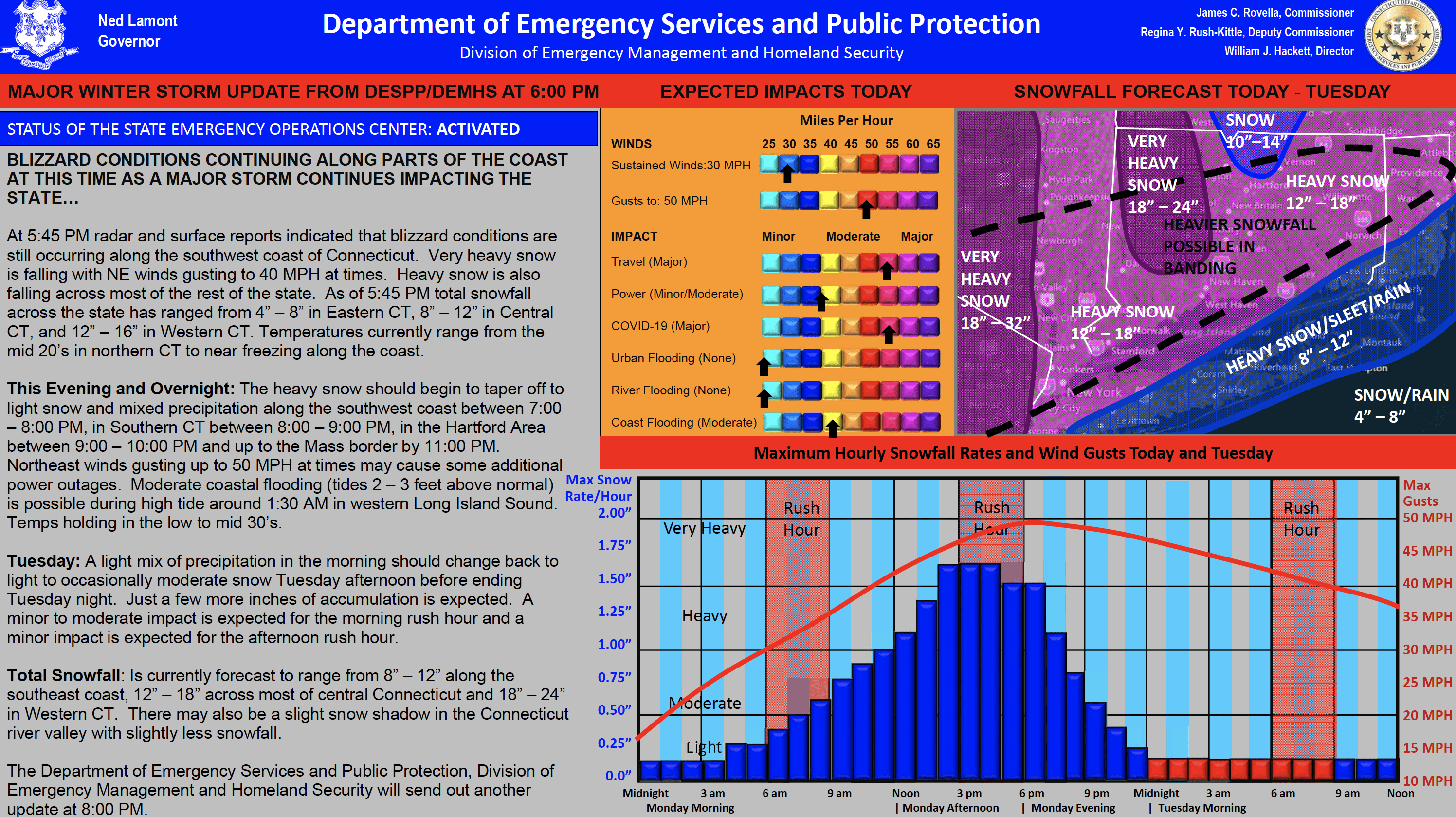
Total Snowfall: Is currently forecast to range from 8” – 12” along the
southeast coast, 12” – 18” across most of central Connecticut and 18” – 24”
in Western CT. There may also be a slight snow shadow in the Connecticut
river valley with slightly less snowfall.
The Department of Emergency Services and Public Protection, Division of
Emergency Management and Homeland Security will send out another at 8:00pm. See graphs below link.