
By Richard Kaufman with Paul Silverfarb
Last week, Punxatawny Phil predicted six more weeks of winter, much to the chagrin of residents in the northeast.
It appears the little fella is on to something.
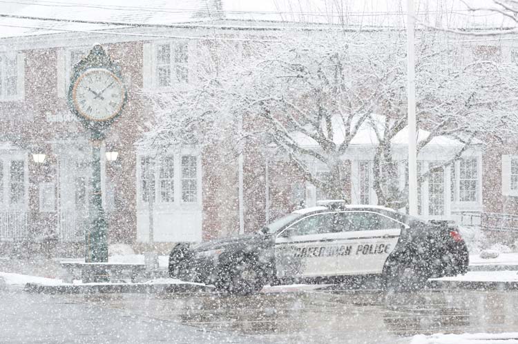
On Wednesday, a wintry mix is expected to impact Fairfield and Westchester Counties. According to Chief Weather Analyst, Jacob Meisel, of swctweather.com, snow is forecasted to begin around 9 a.m., which will eventually turn in to sleet and freezing rain by noon. By 2 p.m., especially along the coast, areas should see all rain.
Temperatures in Greenwich should rise above freezing by 3 p.m., at the latest, and conditions will start to improve going into the evening; warmer temps and moderate rain could potentially melt any accumulated ice.
Overall, inland Fairfield County is expected to see 1-3 inches of snow, with up to a quarter-inch of ice. Coastal areas are forecasted to get a coating to two inches of snow, and a tenth-of-an-inch of ice.
“It won’t be an all-day event,” Meisel said. “The morning commute should be fine, and the evening commute should actually be fine. If anyone has early or mid-afternoon travel plans, they’ll have to be a little more on alert.” The worst travel times on the road projects to be between 10 a.m., and 2-3 p.m.
Meisel said getting students to schools in the morning shouldn’t be an issue, but a worst-case scenario would be if the schools that open dismiss their students early. “Dismissing early might avoid some of the freezing rain, but you’d still be on snow-covered, or sleet-covered roads,” he said. According to swctweather.com, “widespread school cancelations” are expected, but Meisel warned school impacts will come down to the wire on Wednesday morning.
Meisel added that February is playing out as expected. “This is generally fitting in with the expectations of February, which is a bit warmer than average with a very active storm track,” he said. “So you’re getting a lot of storms, but they’re not going along the classic storm path that would bring significant snow or nor’easters. It’s more, they’re cutting a little bit further to the west, but bringing up more warm air.”
There’s a risk the month of February ends with about 10 days of cold weather, Meisel said, but the pattern going forward should see a back-and-forth in temperatures, with shots of colder weather followed by storms that start with snow but turn over to sleet and rain.
For more detailed information and forecasts, go to www.swctweather.com.