
By Richard Kaufman
Sentinel Reporter
Following the Civil War in the 1860’s, the importance of land records skyrocketted.
In 1871, Joseph Andrew Kirby founded J.A. Kirby Co., an engineering company, in nearby Port Chester, N.Y. At the end of the 19th century, J.A. Kirby’s surveys, sewer designs, road designs and stormwater designs helped shape the Village of Port Chester.
Fast forward nearly 130 years, and the company is now known as Ahneman Kirby, after Thomas Ahneman and Ahneman Associates purchased the business in 1998. The business offers services related to civil engineering, structural engineering as well as land surveying.
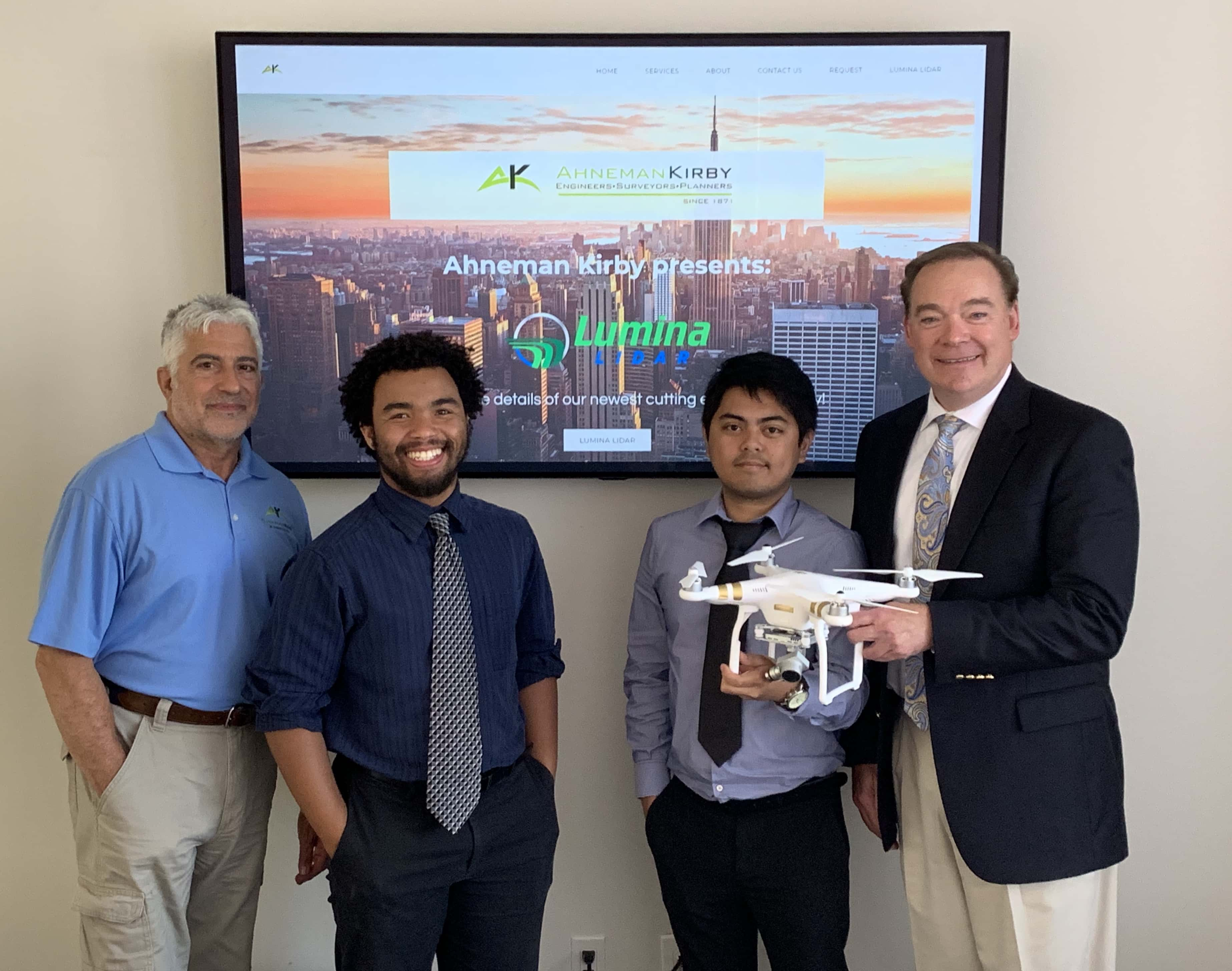
Roughly 50,000 of J.A. Kirby’s plans are located in Ahneman’s office in Riverside, and many of them are still used today. But as Ahneman Kirby carries on the legacy of J.A. Kirby, it is doing so with a revolutionary technology that is becoming a game changer for surveying.
Lumina LiDAR (Light Detection and Ranging) reconnaissance uses remote sensing equipment, either through terrestrial, aerial (drones) or mobile scanning, to give institutional and municipal clients highly detailed and accurate 3D models of properties, structures or roads and highways.
“This is a new technology we’ve invested heavily in. It’s a great technology,” Ahneman said, noting that there are only a handful of firms in the United States with this kind of capability. “A lot of our clients are still living in a 2-dimensional world, and LIDAR gives us 3-dimensional capabilities. We’re in that transition at this stage. I see the world going 3D, but it’s going to be a slow evolution.”
One scan from a drone that’s anywhere from 75-200 feet in the air above a roadway takes 45 seconds, and can collect up to 40 million points down to two centimeters in precision, to show intricate, detailed images of things like roadbeds, signs, guardrails, utilities, foliage and exit ramps.
“It’s a lot of fun. You always get to meet people when you’re out flying the drone. Everyone wants to come say hello. We’ve flown a lot of interesting projects locally,” he said, pointing out the Presbyterian Church in Rye, N.Y., and the Columns Building in Greenwich.
Ahneman noted that it’s mind boggling how technology has changed since he first started surveying with his father, first growing up in Yorktown Heights, N.Y., and later in Greenwich where he moved at the age of 16. He added that the technology is safer for his team and clients.
As the on-call surveyors for the Town of Greenwich, Ahneman and his team will have to scan a section of the Post Road in Cos Cob and some of the flood prone areas.
“The nice thing about the Post Road is we don’t have to set up and run guys across the road with a staff and take shots manually. The safety of being able to sit on the sidewalk and scan and get the entire roadbed without ever sending anybody in the roadway is important,” Ahneman said. “There’s less manpower, too. The scanner [device] never calls in sick, never asks for vacation days. It just wants to make sure its batteries are charged.”
If Ahneman were to survey the Cos Cob project the old fashioned way, he’d have a finished product in 60 days. Now, after a scan is taken, it’s filtered out and refined. A final CAD Drawing, or point cloud, is ready within 2-3 weeks.
The technology is also more cost-effective. For example, Ahneman Kirby is going to do a project for Sikorsky, which has a helicopter factory in Stratford, Conn.
Sikorsky wants to put a spray booth on their factory floor, and they want to know the most cost-effective location for it where they can ventilate it through the roof.
“They need a good accurate existing conditions survey of their facility, so they hired us. We’ll give them a 3D model so they can position their spray booth and get through the roof in the most cost effective manner without relocating a bunch of utilities,” Ahneman said.
Ahneman recently opened an office in South Carolina, and said LiDAR can be used for the historic preservation of buildings in cities like Charleston.
“Once you capture a scan, it’s good for a lifetime,” Ahneman added. “The LiDAR can capture the actual building, existing conditions, then if you have to match those existing conditions, you would have an exact replica that you can work off of. That’s why the scalability and accuracy is so important, especially if you’re working on a historic preservation project.”
Ahneman can also help the Department of Transportation as a consultant on various projects.
“They may not be making the investment in equipment, and in training and software, because it would take an enormous amount of capital for them to get up and running. What we’re trying to do is help them with their 3D inventory as consultants,” he said. “We’re sort of the recon team. We refine it, we package it, so that they can use it. We’re sort of facilitating the process.”
LiDAR can also be used for Emergency Operations Centers to show town officials and residents damage from severe storms.
Going forward, the sky is the limit for Ahneman Kirby. Literally.
Ahneman received his pilot’s license in 2008 and owns a Bonanza aircraft. He’s currently working with Ohio University to outfit LiDAR on a fixed wing airplane.
“The gameplan is to fly my own plane with LiDAR on it,” Ahneman said with a smile. “That would be a lot of fun.”
For more information on Ahneman Kirby, go to ahnemankirby.com.

