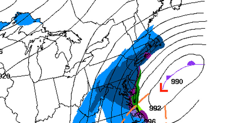

UPDATED: Saturday, Jan. 23 at 12:41 a.m.: Looks like the storm is going to be dumping a bit more snow on the town of Greenwich.
Since the last post, that could be viewed here, the National Weather Service has updated its data and there are some significant changes.
First off, the amount of snow has increased. According to the National Weather Service, in the early morning hours of Saturday, Greenwich will pick up one to three inches of snow. However, Saturday into Saturday night, the area is going to have 11 to 16 inches of additional snowfall, bringing the total snowfall for this storm anywhere from a foot to 19 inches.
Starting at 2 a.m. on Saturday, the National Weather Service will issue a blizzard warning that will stay in effect until 7 a.m. on Sunday.
During that time, winds will be around 20 to 30 miles per hour, with gusts up to 50 miles per hour. In addition, there will be times where the visibility will be near zero.
A blizzard warning means severe winter weather conditions are expected or occurring. Falling and blowing snow with strong winds and poor visibility are likely. This will lead to whiteout conditions, making travel extremely dangerous.
In addition to the blizzard warning, the National Weather Service has also issued a coastal flood advisory from 10 a.m. to 2 p.m. Saturday and again from 9 p.m. on Saturday to 1 a.m. on Sunday.
Check back here for updates on our first winter storm of the season.

